Tara Hill Hike
Tara Hill is a hill dominating the landscape over Gorey, Court town and Castletown. Tara hill is only 253m high but as it sits beside the gorgeous Wexford coastline it provides extensive panoramic views of the sea and distant larger mountains. Tara hill village seems like a small Irish village with the usual small Irish town facilities. Tara Hill hike is perfectly situated as it is only a 10-minute drive off the N11 road, which is the main road from Wexford and Dublin. This hike can provide a perfect 45-minute break from the monotony of motorway driving.
Tara Hill looped Hike Start Point
We did the usual thing of just putting’Tara hill’ into google maps to find the location, occasionally, this doesn’t work and it brings us to the wrong location but this time it brought us straight to the starting point of the intended hike. We took exit 22 from the N11 motorway, for Gorey/Inch and drove towards Gorey on the R722 until we got to the road junction L5032 road for Ballymoney or the Seafield hotel. We continued on this road for about 4-5 km and turned left at a Y junction with a sign for Tara hill on a stone. We drove 1 km up the road then took the next left. We continued driving up the hill until we seen the Tara hill lopped walk signs.

There is a small car park at the start of the hike that fitted about 3-4 cars maximum, so try to come early. As we walked, we saw that there was another car park available closer to the village beside the national school. We were lucky and parked the car safely in the one small remaining space at the start of the blue hike.

The sign for the Tara hill hike shows two possible routes, the red lopped walk, and the blue looped walk.
- The red loop is 5km and goes around the base of the hill.
- The blue loop is 5.4km goes up the hill and gives amazing views.
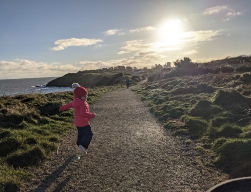
When we go hiking we always seem to go instinctively for the longest and highest hike and this hike was no different, we decided to go for the blue looped walk. We started walking from the car park following the signpost going up the small cul-de-sac residential lane. This part of the walk was very quiet, with no traffic to worry about, as we gained elevation we started to get views of the sea and the lovely Wexford coastline.

We walked to the end of the tarmac lane where the blue and red loop split, the blue loop enters the wood and has 4-5 large rocks entering a cleared forestry.
 Within 1-2 minutes of walking into the forestry, the trail will gain in elevation quickly. The trail will follow a zig-zag pattern up to the top of the blue looped.

There is a small seating area among a rocky area of the trail that provided us with the best views of the day. When we hiked this walk there was a bad wind chill so we didn’t hang around here too long as it was quite exposed. This seated area would be perfect to relax and take in the amazing Irish landscape, as the views don’t get much better than this.

After this seating area, we continued further up the hill, we came to a T junction but unfortunately, the signpost was knocked down. We stood there and tried to guess which was the right direction but I think we guessed the wrong route. We continued straight ahead until we came to another T junction where we could see windmills in the Sea in the distance. There was another blue arrow pointing us right at this junction, we followed it and started walking downhill again.

This was another nice section of the hike as we were walking towards the sea views, the cold winter wind was behind our backs and the forestry has been replanted with eucalyptus trees. We walked downhill for a couple of kilometers unaware that we had taken a wrong turn somewhere.
Halfway through the downhill section, we had a small picnic but as it is winter and VERY cold we just kept walking and eating. Our little hiker LOVES mandarin oranges at the minute so we all had some fruit to keep our energy levels up.

We continued walking downhill until we got to an open yellow metal barrier but there were no more Blue arrows to be seen, only one red arrow pointing into the wood. We walked down to a carpark at the bottom of the lane about 50m away but there were no more blue arrows to be seen here either. We walked back to the Red arrow sign, which cut through the bottom of the wood on a muddy footpath, we followed this sign as we knew it would bring us back to the start.

We walked on the muddy path until we came to a farm gate, which also brought us onto a small country lane but thankfully the red arrows were very consistent at this stage of the trail.

Like most small hikes in Ireland, there will be a section of road walking and the Tara hill hike was no exception. This section was on a very tight country road with limited stand in sections when cars came, the road was very busy when we were walking it, we probably met 5-6 cars in the 500-600 meters of road.We didn’t mind this too bad as this section of the trail brought us past Tara village Catholic church, which we walked in around to admire the building.

We were delighted that the church doors were open as we always love walking into churches for a quick break. The church is called Saint Kevins and was built between 1939-1941. St Kevin’s church is a small church which gives it a very welcoming warm feeling. The Christmas nativity scene was still up when we visited and our daughter seemed very impressed when we gave her a closer look at all the detail. The church had amazing vaulted ceilings with exposed beams and is well worth a visit when hiking this trail.

We walked back out of the church and walked towards the junction beside the national school, where we saw another Red sign. We continued past the national school up the hill on a footpath where there was another carpark, which the red loop could be walked from.

We continued up the road but the footpath quickly disappeared and we were back to walking on the side of a very small busy country road, this section might not be suitable for a pram. Another Red sign appeared about 1km on this road and we turned onto an even smaller road which was another cul-de-sac and was very quiet.

Turn left here onto a cul-de-sac
This small cul-de-sac road starts to rise sharply and follows the edge of the side of the hill contours, the road starts to turn muddy but also becomes very sheltered as the hill is now to our side and it blocks the cold sea air.

This was a very enjoyable section of the walk as it was reasonably flat and it felt like we were walking through the middle of the Wexford countryside, you could nearly imagine these roads were used with horse-drawn carts maybe a century ago.

The grassy country lane continued for another couple of kilometers and was slightly overgrown but this added to the character of the hike. The lane then turned back into a tarmac road again which quickly revealed our car around a corner.
Conclusion of our Tara Hill Hike
To be honest, when we set out to do the Tara hill hike we didn’t have high expectations, as we couldn’t find much information online about it. As we got lost it was hard to give an accurate distance but we clocked it at around 7.5km with the mixture of the Blue and Red looped walks, this took us 2 hours to complete but we had a lot of stops and breaks to admire the views when we could.
The hike has amazing views and is nicely challenging without the need to climb a larger mountain. Boots are necessary for winter, I’d imagine you would get away with hiking shoes in summer as there were only a few areas that had mud in the depths of winter. If you are passing Gorey and need a break this hike is a must, and we highly recommend it.
There were only a few problems we found with the hike;
- Signposting was very poor and sporadic in places
- Where we parked it was only limited to 3 cars
- Road walking for a couple of Km’s on very tight roads.
The issues above would not stop me from recommending this hike.


